Key Facts
| Location | Potrerillos Concession |
| Size of Target Area / Area Drilled | 25 km2 / 0 km2 |
| Distance from Processing Plant | 1.1 to 3.5 km North of San Albino mill |
| Targeted Mining Method | Open Pit and under-ground potential |
| Targeted Metal | Au, Ag |
| Targeted zone | San Pablo, Mina Francisco, Intermediate |
| Deposit Type | Orogenic – High grade Au, shallow dipping 1-2m wide stacked veins |
| Ownership | 100% |
Description
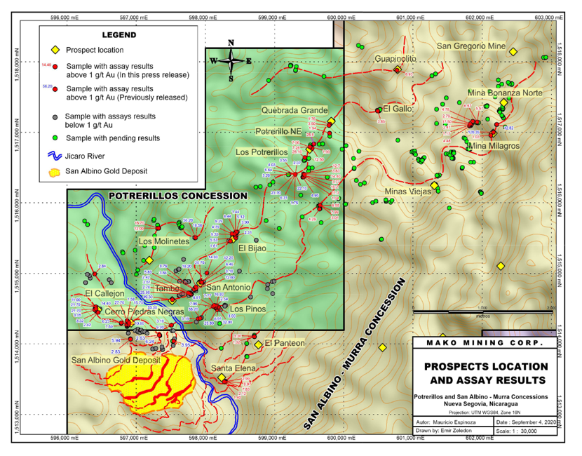
The Potrerillos Concession is comprised of 12 square kilometers of sub surface mineral rights and is contiguous to and along strike with the San Albino deopsit.
Preliminary prospecting and mapping on the Potrerillos Concession to date has identified at least nine prospects with similar characteristics to San Albino indicating potential continuity of at least three gold bearing structures over the length of the Potrerillos Concession of approximately 3.5 km.
The Company’s geologists believe that the newly identified prospects on the Potrerillos Concession represent a mineralized trend link between San Albino and several prospects within the San Albino-Murra Concession along a northeast striking trend that runs for approximately 9.5 km.
Outlook
In 2022 the Company plans to initiate a diamond drilling program with the objective of defining additional resources that can be processed at the nearby San Albino Mill approximately 1 to 3.5 km to the south. Mako is planning to drill approximately 21,000 metres at the Potrerillos and La Segoviana concessions in 2022.
Exploration
The exploration permit for Potrerillos was obtained on Nov 15, 2021, the permit is valid for 10 years and is renewable for up to an additional 20 years. The Company is now permitted to drill up to 800,000 meters (“m”) as follows: 250,000 m of diamond drilling; 250,000 m of reverse circulation drilling; and 300,000 m of blast hole drilling. The Company is also permitted to carry out up to 12,000 m of trenching.
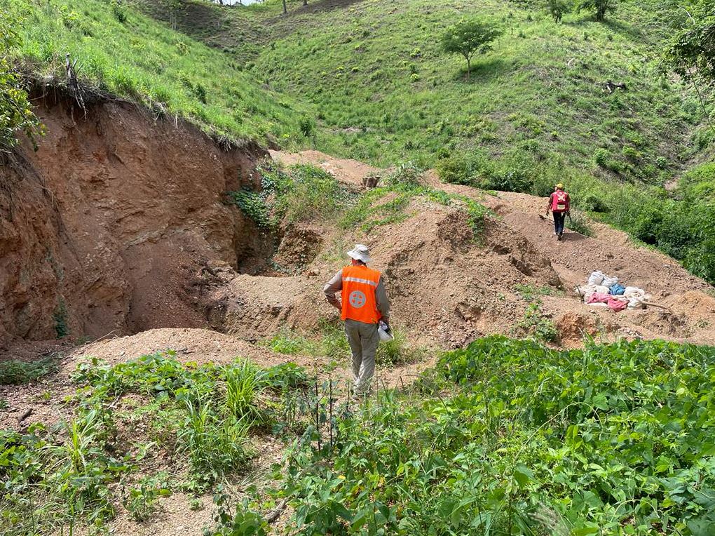
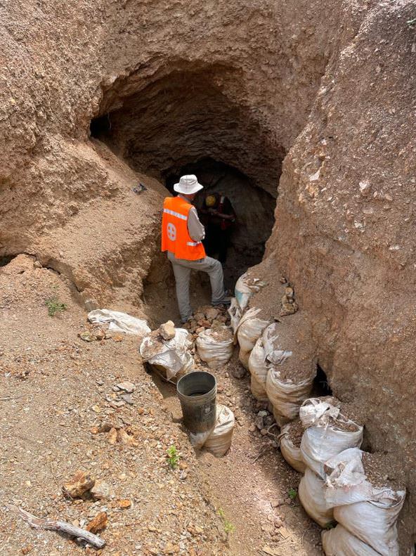
All exploration on the property to date has consisted of prospecting existing workings and extremely limited outcrops. Below is a description of the prospects encountered to date:
Cerro Piedras Negra
The Cerro Piedras Negra prospect is situated approximately 380 m north of San Albino. This prospect is comprised of two collapsed adits, ten hillside cuts, two small pits and eight relatively small adits, which appear to be following a vein over a distance of 1,300 m. In total, 20 samples were collected, mostly from historic dumps, with gold grades up to 33.30 g/t Au.
El Callejon
The El Callejon prospect is situated just northwest from the Cerro Piedras Negra prospect and is comprised of a collapsed historical adit, a shaft, four historical cuts and five dumps. Sampling of a dump in front of a collapsed tunnel yielded the highest result of 21.70 g/t Au and 175.0 g/t Ag.
San Antonio, Tambo, El Bijao and Los Potrerillos
The most extensive prospects discovered to date on the Potrerillos Concession are San Antonio, Tambo, El Bijao and Los Potrerillos, which appear to be developed on the same structure with a strike extent of at least 2,500 m. The prospects are centered around quartz veins similar to San Albino with occasional visible gold, galena and arsenopyrite. The veins were initially mined by the Spanish in the 1700’s with later activity in the 1800’s and more recently by local, small-scale miners using manually intensive mining methods.
San Antonio – Five tunnels, 11 cuts, nine dumps, five shafts and have collected 17 samples. Sampling of a dump in front of one of the tunnels returned 25.90 g/t Au and 28.0 g/t Ag.
Tambo – Three adits, seven cuts, two dumps and a shaft have been identified and 14 samples were collected. Sampling of an outcropping quartz vein in the area returned assays of 49.30 g/t Au and 66.0 g/t Ag over 0.5 m.
El Bijao – Six adits, 12 cuts, four shafts, three dumps have been identified and 12 samples were collected, including a 1 m channel sample of an outcrop yielding 8.44 g/t Au and 19.5 g/t Ag.
Los Potrerillos – Eight adits, 19 cuts, seven shafts and two dumps have been identified. A total of 43 samples were collected, including several samples of outcrops with the best results coming from channel samples yielding 23.70 g/t Au and 65.0 g/t Ag over 1.0 m true width and 1.7 m down dip of 22.10 g/t Au and 45.0 g/t Ag.
Los Pinos
The Los Pinos prospect appears to be developed on a sub parallel structure approximately 400 m south of San Antonio with a strike extent of at least 1,300 m. Mapping has identified two collapsed adits, 18 cuts and a dump. A total of 18 samples were collected. The best results came from dumps developed next to hillside cuts returning assays of 55.20 g/t Au and 141.0 g/t Ag and 32.00 g/t Au and 226.0 g/t Ag.
Los Molinetes
The Los Molinetes prospect appears to be developed on another parallel structure approximately 800 m to the north of San Antonio and is comprised of two collapsed adits, nine cuts, a shaft and two dumps. A total of 13 samples were collected, most of the assays are pending, however a grab sample from a dump in front of a collapsed tunnel returned assays of 56.20 g/t Au and 57.0 g/t Ag.
Quebrada Grande
The Quebrada Grande prospect is situated approximately 500 m north of Los Potrerillos and along strike of the San Antonio, Tambo, El Bijao and Los Potrerillos prospects, extending the potential strike extent to nearly 3 km. A total of nine samples were collected and are pending results.
Reconnassiance Highlights (Channel Samples)
- 49.3 g/t Au and 66.0 g/t Ag over 0.5 m
- 23.70 g/t Au and 65.0 g/t Ag over 1.0 m
- 8.44 g/t Au and 19.5 g/t Ag over 1.0 m
Note: channel champles are limited at Potrerillos due to limited surface exposures and lack of trenching.
History & Milestones
- 2019 – Dec 17 - Acquired Concession
- 2021 – Nov 15 - Exploration Permit obtained
Media & Photos